
How to make a map of the places you've traveled
The best record of where you've been is already in your pocket: every photo with location data is a pin waiting for a map. You shouldn't have to place them by hand.
Bloggo turns your camera roll into a places-visited tracker — every restaurant, trail, and city you photographed, browsable by year and category, plotted on a private map.

How to do it with Bloggo
- 1
Let Bloggo scan your photos
The on-device scan reads the location stored in each photo and builds your places list from it.
- 2
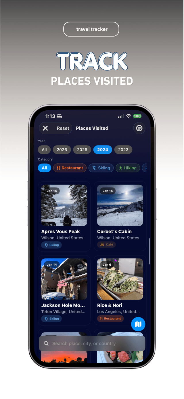
Open 'Places Visited'
Every place appears as a card with its photo, date, and category — skiing, restaurants, hiking, cafés.
- 3
Filter by year or category
Jump to 2024's restaurants or every trail you've ever hiked. The filters make the archive browsable.
- 4
Switch to the map view
See your pins across the country, and tap any trip to relive it.
Common questions
Where does the location data come from?
From the metadata your iPhone saves with each photo. Bloggo reads it on your device.
Can other people see my map?
No. The map is private and on-device. It's a record for you, not a feed for others.
Does Bloggo track me in real time?
No. Bloggo only reads the location stored in photos you've already taken.
Try it on your own photos
Bloggo is free to download. Your first blog takes seconds.